Rapid LiDAR site analysis for people who work with land, not software
Clarity before you commit …to placing a road where water wants to go
Instead of spending hours wrestling with tedious GIS workflows, LandScope finds the best available LiDAR data for your site and rapidly processes it into intuitive terrain overlays, drainage, slope, and aspect layers.
Explore the results in one shared workspace, compare possibilities with your team, and make better-informed decisions before decisions get expensive.
No credit card required. Explore your site first, then bring your team in when you’re ready.
LandScope is trusted by:





Start free, with no install, credit card, or delay.
Create your LandScope account and start a new project in minutes. Everything runs in your browser, so you can go from signing up to working map without a call or software setup.
Draw your boundary and check the coverage.
Trace your property line on the map and LandScope will show whether LiDAR covers the area before you begin. You know right away whether a full terrain read is possible, before you spend time setting anything up.
If it isn’t covered, you can upload your own digital elevation model.
Read beyond the boundary line, at the detail your project needs.
Water does not care about property lines, so expand the analysis area to see what arrives from uphill and what leaves your site. Then set the contour interval to match the decision in front of you, from reading a whole valley to working out a house pad, pond, or access line. Every contour is generated directly from LiDAR, not copied from coarse county mapping.
Get the full terrain read without the usual wait.
Once you hit go, LandScope handles the LiDAR sourcing, processing, and hydrology run for you. Watch your complete site analysis reveal itself with slope, water flow, wet ground, and landforms already mapped and explained in plain language.
See the site in 3D, not just from above.
Switch into 3D to read slope, landform, and water movement in a way flat maps can miss. It is the fastest way to turn a finished analysis into a more intuitive understanding of how the land actually behaves.
Work the map with the tools your team actually needs.
Use the toolbar to draw polygons, run cross sections, measure distances, mark ideas, upload photos, leave comments, and bring collaborators into the same workspace. Instead of passing files back and forth, your team works from one shared view of the land.
Trusted by the people who work with land:
"It didn't replace intuition, it amplified it. LandScope translated what the land already knew into clear, visual truth."
"LandScope provided exemplary visuals and a level of service that saved this engineering company hours of time and outsourcing."
"I formed an initial list of price negotiation points before even seeing the site in person. It enabled a depth of insight impossible to do through site visits alone."
"I can produce initial assessments in half the time and present clients with a foundation that feels like having a lifetime of information at their fingertips."
"It saved us countless hours in preliminary schematics and provided sensitive data on building placement in the context of flooding and fire potential."
"LandScope has enabled me quite simply to do things I could not have done otherwise. I was absolutely stunned by the Hydrology and Drainage layers."
"The hydrology features are pure gold. Plus, the slope feature helps us meet defensible space requirements in wildfire-prone regions."
"LandScope saves us countless hours and gives us clear, actionable insights—from contours to drainage flowlines—streamlining our planning process."
"It didn't replace intuition, it amplified it. LandScope translated what the land already knew into clear, visual truth."
"LandScope provided exemplary visuals and a level of service that saved this engineering company hours of time and outsourcing."
"I formed an initial list of price negotiation points before even seeing the site in person. It enabled a depth of insight impossible to do through site visits alone."
"I can produce initial assessments in half the time and present clients with a foundation that feels like having a lifetime of information at their fingertips."
"It saved us countless hours in preliminary schematics and provided sensitive data on building placement in the context of flooding and fire potential."
"LandScope has enabled me quite simply to do things I could not have done otherwise. I was absolutely stunned by the Hydrology and Drainage layers."
"The hydrology features are pure gold. Plus, the slope feature helps us meet defensible space requirements in wildfire-prone regions."
"LandScope saves us countless hours and gives us clear, actionable insights—from contours to drainage flowlines—streamlining our planning process."
"From topography to drainage, this tool gives us a comprehensive overview in very little time. The abundance of information always impresses our clients when pitching."
"LandScope proved theories we already had and showed connections that weren't clear, making our water retention work much more reliable."
"We didn't feel ready to spend thousands on a wetland delineation for land we might not buy. LandScope bridged the gap and cut out the stress of feeling stuck."
"I thought I knew every inch of our land. The detailed layers revealed patterns that explained landscape features I'd been observing daily."
"LandScope provided scientific validation for our design decisions—proving instrumental in securing stakeholder buy-in for our ambitious restoration plans."
"What used to take hours of clicking through government databases now takes just a few minutes. It makes the process feel clear and even enjoyable."
"This multi-layered analysis revealed vulnerability clusters impossible to identify through conventional methods, significantly strengthening the overall rigor of my dissertation."
"Quick access to LandScope's maps dramatically improved our workflow and decision-making across the natural parks we manage."
"Nothing comes close to what LandScope provides. Finding the common elevations around a property before pulling out my laser saves days of work."
"From topography to drainage, this tool gives us a comprehensive overview in very little time. The abundance of information always impresses our clients when pitching."
"LandScope proved theories we already had and showed connections that weren't clear, making our water retention work much more reliable."
"We didn't feel ready to spend thousands on a wetland delineation for land we might not buy. LandScope bridged the gap and cut out the stress of feeling stuck."
"I thought I knew every inch of our land. The detailed layers revealed patterns that explained landscape features I'd been observing daily."
"LandScope provided scientific validation for our design decisions—proving instrumental in securing stakeholder buy-in for our ambitious restoration plans."
"What used to take hours of clicking through government databases now takes just a few minutes. It makes the process feel clear and even enjoyable."
"This multi-layered analysis revealed vulnerability clusters impossible to identify through conventional methods, significantly strengthening the overall rigor of my dissertation."
"Quick access to LandScope's maps dramatically improved our workflow and decision-making across the natural parks we manage."
"Nothing comes close to what LandScope provides. Finding the common elevations around a property before pulling out my laser saves days of work."
LandScope is made for you
For Architects
Change orders from terrain surprises don't happen because architects miss things. They happen because the data arrived too late. LandScope puts decision-grade site analysis in your hands in seconds — before design begins, not after it's already wrong.
Not sure what you'd get? Let us show you. Book a live walkthrough and we'll map your site together — your questions, your site, zero obligation.
25+ terrain views, one clear answer.
Get a LiDAR lay of the land before you stake time, reputation, or capital on assumption.
See what works, what won't, and what could—in minutes, without opening GIS software. Every package includes 25+ LiDAR terrain layers that reveal opportunities to capture and problems to avoid. Get the clarity you need to decide—or if it doesn't deliver, hop on a quick call with us and we'll refund you.
Contour Lines
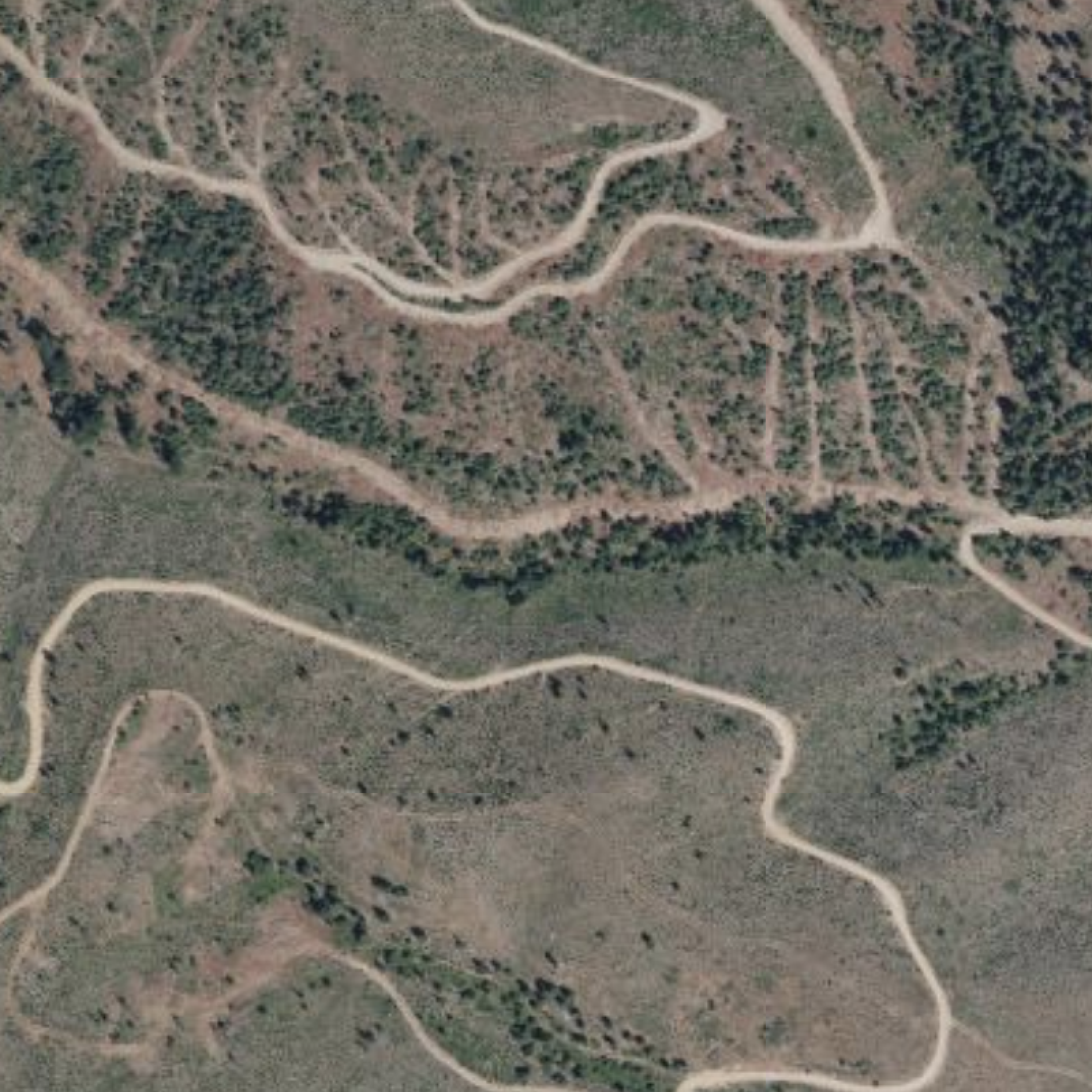
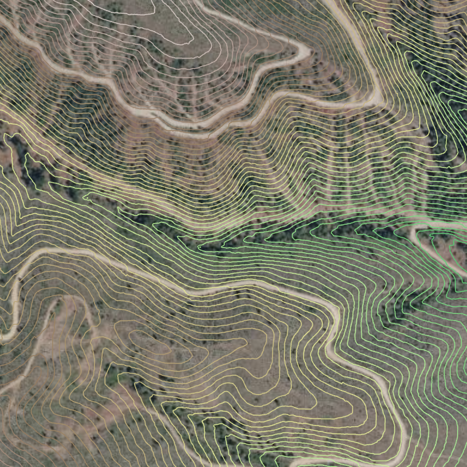
Topographic contour lines showing elevation at consistent intervals — the traditional mapping format professionals rely on for precise site analysis and planning.
Key Benefits
- → Visualize terrain in the familiar contour format used by surveyors, engineers, and planners
- → Identify slope gradients, ridges, and valleys through contour line spacing and patterns
- → Export contours for integration with CAD, GIS, and design software workflows
Coverage
Where maps are ready instantly
LandScope sources LiDAR automatically from national elevation programs in 12 countries. Draw a boundary in any of them and your map starts processing straight away, with no data to find, request, or prepare.
Coverage inside a country is not always complete, so the app shows exactly what is available on your site before you start.
Outside these areas, or need a more recent scan?
Upload your own digital elevation model (DEM) and LandScope processes it the same way. That covers sites with no public LiDAR, and sites where you have newer data than the national program, such as a recent drone or aerial survey.
No credit card required.
Before LandScope
Expensive, fragmented,
and still not clear.
- Paying the GIS tax in software, specialists, or lost time
- Waiting on survey files, consultants, or disconnected workflows before planning can start
- Working from tools that look precise until you zoom into the real site
- Making high-stakes decisions without a clear read on water, slope, and constraints
- Passing static outputs around instead of working from one shared view of the land
After LandScope
Clear, collaborative,
and ready in minutes.
- LiDAR-based terrain intelligence in minutes, not weeks
- A shared 3D workspace to explore, question, and understand the site
- Simple, powerful tools for sections, polygons, measurements, sketching, and markups
- Photos, comments, collaborators, exports, and print from one source of truth
- Better land decisions without hiring a GIS specialist or becoming one yourself
Read land as a whole system before you design, buy, build, or plant.
LandScope helps land professionals save time, validate decisions earlier, identify risks sooner, and present stronger plans with more confidence.
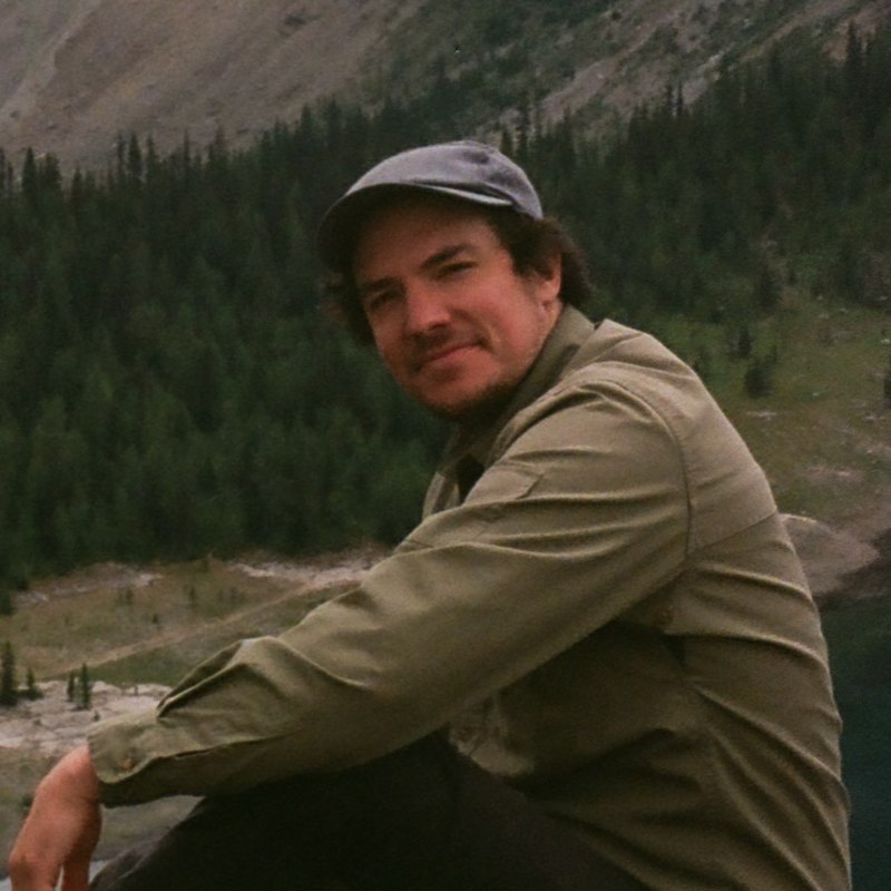
I started LandScope after seeing the same land-analysis problem from four sides: as a student of physical geography, as a teacher helping students understand land systems, as the person answering customer questions, and as a landowner making real decisions on real land.
With two degrees in physical geography and experience helping students, designers, and land stewards work with terrain, water, and climate data, I kept seeing the same gap: the insight was valuable, but the workflow was slow, fragmented, and unnecessarily technical.
LandScope is my answer: a faster, more collaborative way to understand how terrain, water, and climate interact, so you can make better decisions before expensive mistakes are made.
FAQ
Common questions.
Read your site as the whole system it is.
See water, terrain, and landscape patterns faster so you can validate decisions, catch risks earlier, and move into the field with better questions.